The beginning
So, one of my interests is making maps for games, but with no artistic ability, I have been limited in what I can do. And so, bring forth the projector! In an attempt to make a map for an adventure/campaign I have rumbling around in my head, I decided to use the projector and some online maps to be able to customize a topographic map of a town.
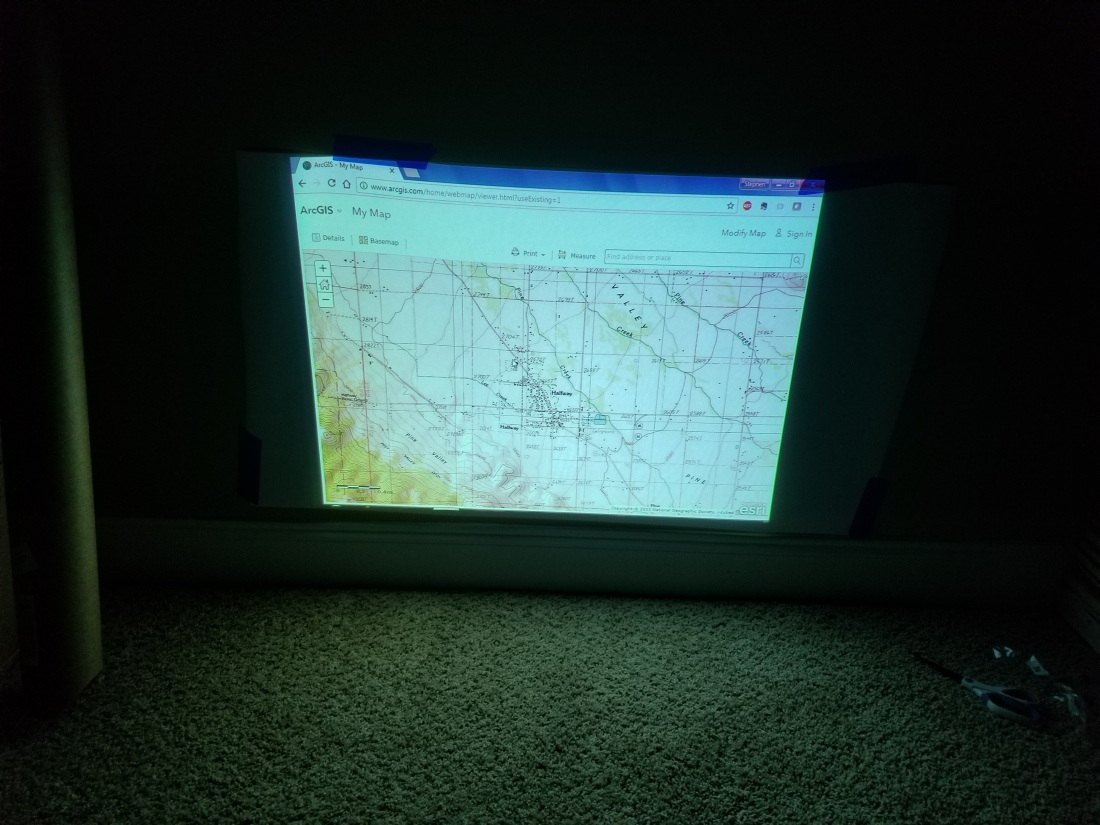
For those interested, the base of the town is Halfway, Oregon. A town of only about 300, I have need of increasing it to about 8-10 times that. I chose Halfway, because it sits nicely in a valley, that is easily cutoff (via road) in all directions. I’m not going to give away what the campaign idea is quite yet, but it will be associated with GURPS and Special Ops characters.
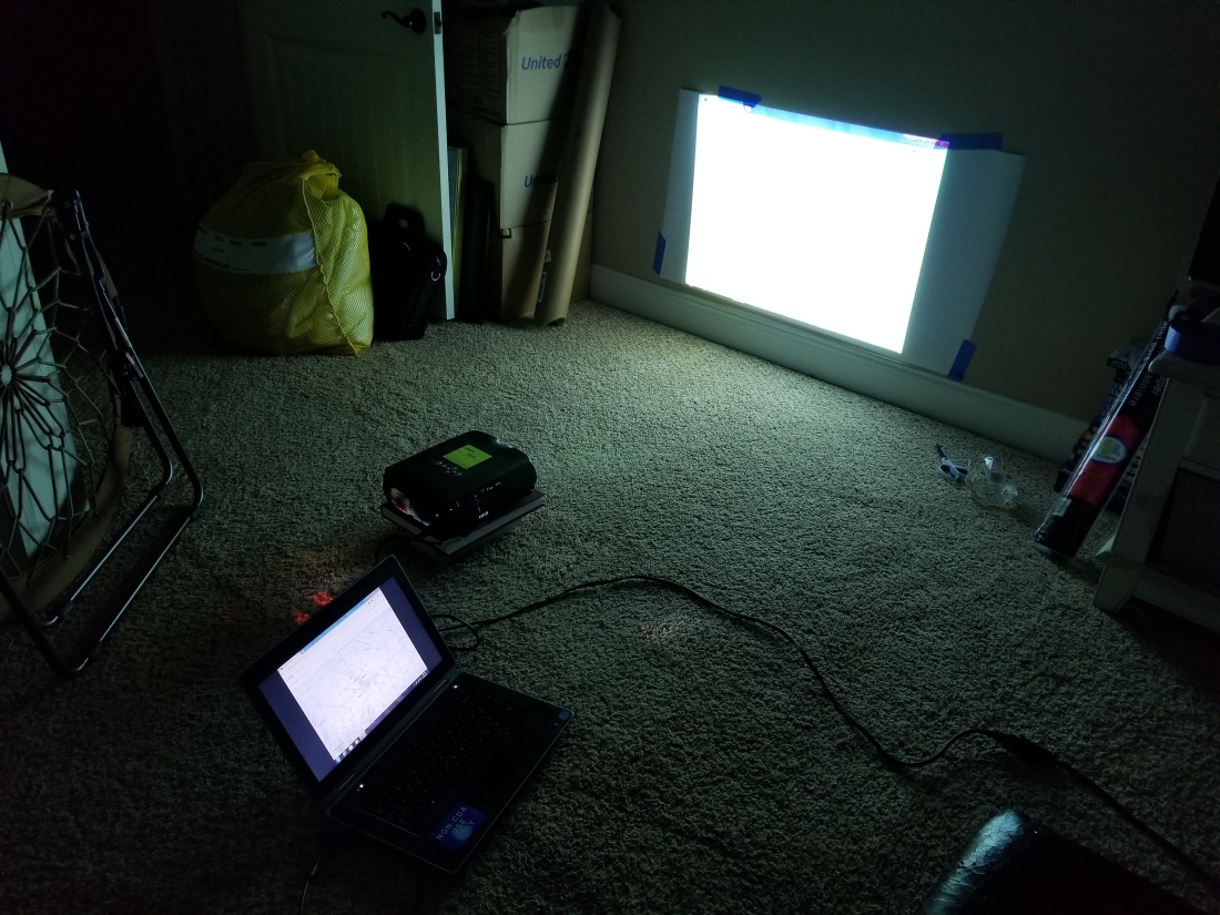
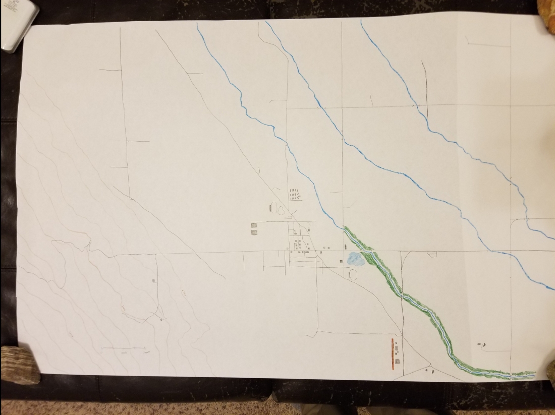
I used the maps available from ArcGIS to get the cartographic layout – that’s what you see over at the bottom left of my map. I’ve added in the topographic lines showing changes in elevation. The map is, of course, a work in progress.
My plans to work on this further are:
- add more buildings/roads to increase the footprint of the town. As mentioned previously, the town has a population of 300, but I’m looking for it to support a population of about 3000.
- add in more vegetation/woods. Most of the area is pretty flat, consisting of farms but few trees.
- add in some points of interest to the campaign. So, essentially I’ll have a “player’s map” and a GM’s map.
Note: For those making modern-day maps, ArcGIS has some incredible free tools, that are probably worthy of a post by itself. For example, if you’re team were to infiltrate and extract a political prisoner from the Badosh Prison outside Mosul, Iraq, you could use this as a GM to help visualize and layout the potential defenses, and you could provide this to the player’s as their satellite intel.
